


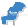
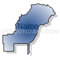
Montezuma 11, Montezuma County, Colorado
About
Outline

Summary
| Unique Area Identifier | 548965 |
| Name | Montezuma 11 |
| County | Montezuma County |
| State | Colorado |
| Area (square miles) | 328.62 |
| Land Area (square miles) | 327.41 |
| Water Area (square miles) | 1.21 |
| % of Land Area | 99.63 |
| % of Water Area | 0.37 |
| Latitude of the Internal Point | 37.34788270 |
| Longtitude of the Internal Point | -108.30560840 |
Maps


Graphs
Select a template below for downloading or customizing gragh for Montezuma 11, Montezuma County, Colorado


Neighbors
Neighoring Voting District (by Name) Neighboring Voting District on the Map
- La Plata 11, La Plata County, CO
- La Plata 28, La Plata County, CO
- Montezuma 2, Montezuma County, CO
- Montezuma 5, Montezuma County, CO
- Montezuma 6, Montezuma County, CO
- Montezuma 7, Montezuma County, CO
- Montezuma 9, Montezuma County, CO
Top 10 Neighboring County Subdivision (by Population) Neighboring County Subdivision on the Map
- Durango CCD, La Plata County, CO (31,507)
- Cortez CCD, Montezuma County, CO (16,796)
- Durango Southwest CCD, La Plata County, CO (5,375)
- Dolores CCD, Montezuma County, CO (3,380)
- Mancos CCD, Montezuma County, CO (3,156)
- Ute Mountain CCD, Montezuma County, CO (1,588)
Top 10 Neighboring Place (by Population) Neighboring Place on the Map
Top 10 Neighboring Unified School District (by Population) Neighboring Unified School District on the Map
- Durango School District 9-R, CO (37,981)
- Montezuma-Cortez School District RE-1, CO (18,573)
- Dolores School District RE-4A, CO (3,736)
- Mancos School District RE-6, CO (3,226)
Top 10 Neighboring State Legislative District Lower Chamber (by Population) Neighboring State Legislative District Lower Chamber on the Map
Top 10 Neighboring State Legislative District Upper Chamber (by Population) Neighboring State Legislative District Upper Chamber on the Map
Top 10 Neighboring 111th Congressional District (by Population) Neighboring 111th Congressional District on the Map
Top 10 Neighboring Census Tract (by Population) Neighboring Census Tract on the Map
- Census Tract 9404, La Plata County, CO (5,375)
- Census Tract 9696, Montezuma County, CO (4,852)
- Census Tract 9707.01, La Plata County, CO (4,547)
- Census Tract 9690, Montezuma County, CO (3,380)
- Census Tract 9691, Montezuma County, CO (3,156)
- Census Tract 9411, Montezuma County, CO (1,588)
Top 10 Neighboring 5-Digit ZIP Code Tabulation Area (by Population) Neighboring 5-Digit ZIP Code Tabulation Area on the Map
- 81321, CO (14,459)
- 81323, CO (4,409)
- 81328, CO (4,069)
- 81326, CO (2,193)
- 81334, CO (1,493)
- 81330, CO (26)